Drone Careers: Exciting Trades
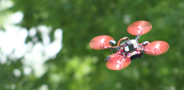
Drones are small, fast and unmanned flying robots that can be fitted with just about any sensor you can imagine, making them the perfect fit for many tedious or dangerous tasks. Through their agility, sensing and mapping capabilities, drones have made their way into many trades looking to improve efficiency and worker safety.
Keep reading to learn ways that drones are being used in fields like construction and agriculture, and how educators can set their students up for success in the ever-growing world of drones!
Mapping & Photogrammetry with Drones:
While orthomosaic mapping and photogrammetry aren’t new concepts, adding in drones takes them to the next level.
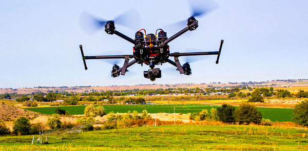
Drones can create 2D or 3D maps of any area by stitching together many high-quality photos into a single model, or orthomosaic. This technique allows drone pilots to conduct land surveys of varying levels of detail to suit a client’s needs. Industries such as construction often use these maps to plan their building projects and communicate their progress with stakeholders.
Check out some of the benefits and techniques behind orthomosaic mapping:
In addition to detailed mapping, photogrammetry has applications in any field where creating 3D models of real-world objects may prove useful. For example, photogrammetry is used in forensic sciences to aid in accident reconstruction and other investigations:
By employing drones, photogrammetry tasks can be completed quicker, more accurately and more safely than sending in a human to document the situation.
Drones in Agriculture:
Due to the vast amounts of land involved, agriculture industries were relatively quick to pick up on the effectiveness of drones as scouts, sprayers, spreaders and more.
Drones can reach fields, buildings or animals much faster and more safely than humans. With the right sensors and payload, drones can be used to monitor crops and livestock, check on structures after storms, and even spread seeds, fertilizer or pesticides more efficiently than a tractor.
Here’s 5 ways that drones benefit agriculture:
More Drone Inspiration:
How to Become a Drone Land Surveyor:
Are your students interested in surveying land with drones? Here’s how to set them up for success in any drone photogrammetry or mapping field:
- Learn Drone Regulations and How to Fly
- Part 107 Certification and Insurance
- Land Surveyor in Training (LSIT) Certification
- Consider a Degree in Land Surveying or Similar
1. Learn Drone Regulations and How to Fly
All great drone pilots start by simply learning how to get off the ground. There are many courses out there that introduce learners to all areas of drone flight, from safety and legal regulations to flying manually and even coding autonomous flight missions.
For educational packages for upper-elementary, middle and high school learning environments, complete with drone equipment, curriculum and educator training, check out PCS Edventures’ popular indoor and outdoor drone programs:
![]()
![]()
![]()
2. Part 107 Certification and Insurance
New drone pilots aspiring to make a profession out of their flying skills will be required to get FAA Part 107 certified. This certification applies to all pilots performing commercial drone flights. PCS Edventures’ drone programs can get your students started learning about drones and exploring potential careers, and our partners at UAV Coach have their licensing needs covered!
Additionally, many employers require their drone pilots to be insured. Educators can learn more about drone insurance in our article, Do I Need Drone Insurance? Know the Facts!
3. Land Surveyor in Training (LSIT) Certification
It is recommended that new land surveyors obtain an LSIT certification. In some states, like California, this certification is the first step toward becoming a fully-licensed professional engineer. It’s important to research what certifications or licenses your state may require for the specific trade you’re interested in.
4. Consider a Degree
While not all drone jobs will require a degree, new drone pilots will find more opportunities in engineering fields like land surveying if they further their education. Many universities offer degrees in land surveying, surveying and mapping or GIS (Geographic Information System) mapping. Some programs may even include the certifications or licenses needed to enter the workforce.
Related Resources:
Interested in the educational applications of drones? Learn more about incorporating UAVs into your learning environment at the links below:
- Blog: Drone Careers: Live Events
- Blog: Drone Careers: Emergency Services
- Blog: Drone Careers: Filmmaking & Cinematography
- Webinar: The Best Drone for STEM Education
- Webinar: Discover Drones as an Instructional Platform
Ready to Start Your Drone Program?
PCS Edventures makes it easy for educators to get started with UAVs! From the basics of flight to choreographed drone performances, our Drone Collection includes indoor and outdoor programs that are perfect for many different learning environments.